

Architecture news rarely signals a shift this fundamental. Japan’s PLATEAU Project is doing exactly that by making high-quality, open-access 3D city models available at a national scale, offering architects, planners, developers, and design-led homeowners a new way to understand how cities work before they are changed in the real world.
Led by Japan’s Ministry of Land, Infrastructure, Transport and Tourism, PLATEAU has emerged as one of the most ambitious digital twin initiatives in the built environment. The program has already released models for more than 250 cities through open public platforms, with a broader target of 500 cities by 2027. For readers tracking luxury architecture, luxury home design, and the future of premium urban living, this is more than a government mapping project. It is a blueprint for smarter, more resilient, and more beautifully coordinated cities.
Architecture News: Why Japan’s PLATEAU Project Matters
At its core, PLATEAU is a national effort to create detailed 3D city models that can be used across planning, mobility, sustainability, disaster readiness, infrastructure, and public engagement. These are not simple visualizations. They are digital twins: data-rich urban replicas that include geometry as well as semantic information such as building use, construction year, roads, and planning-related attributes.
That distinction is critical. Traditional 3D models often help people see a place. Digital twins help them analyze it, test it, and improve it. In today’s architecture news cycle, where design technology increasingly shapes how projects are conceived and managed, PLATEAU stands out for combining scale, openness, and practical use.
The initiative began in 2020 with 15 cities, expanded rapidly, and now covers a significant share of Japan’s urban geography. Users can access the data through the G-Spatial Information Center and explore many of the models in the browser-based PLATEAU VIEW platform.
What Makes These 3D City Models Different?
PLATEAU’s value lies in how the data is structured and standardized. The project introduced a national specification for 3D city models in 2021 and has continued refining it, helping unify quality requirements, formats, and interoperability. The models are based on CityGML, an international standard for representing 3D urban and landscape data.
In practical terms, this means the platform is designed to be:
- Scalable for nationwide adoption
- Compatible with multiple software environments
- Useful for governments, private firms, researchers, and communities
- Open enough to encourage innovation rather than restrict it
For professionals following architecture news, this is especially important because standardization often determines whether a digital tool remains a niche experiment or becomes part of everyday practice.
Built From Existing Data, Not Starting From Scratch
One of the smartest aspects of PLATEAU is its production method. Instead of generating every dataset from zero, the project reuses existing survey reports, GIS resources, BIM inputs, and point cloud data. That lowers costs and makes expansion more feasible across hundreds of municipalities.
This also democratizes access. Data that might otherwise remain fragmented across local agencies becomes part of a shared public resource, creating a more level playing field for design teams, civic groups, and technology developers.
How Digital Twins Could Transform Urban Design and Luxury Living
Although PLATEAU is a national urban initiative, its implications extend directly into the world of luxury architecture and luxury home design. Better city data supports better decisions about sunlight, views, energy use, walkability, mobility, and neighborhood character—all key factors in premium real estate and high-end residential planning.
Potential applications include:
- Urban planning and public participation through clearer visualization of proposed changes
- Disaster prevention and simulation in a country where resilience is essential
- Environmental analysis for solar access, heat island mitigation, and ventilation studies
- Infrastructure monitoring to improve maintenance and long-term asset performance
- Tourism and regional revitalization by making cities more legible and marketable
- Mobility planning including routing, mapping, and autonomous vehicle integration
For the luxury sector, these capabilities can influence everything from where to position a terrace to how a residential district balances privacy, views, and environmental comfort. That is why this architecture news story resonates well beyond policy circles.
Design Intelligence for the Next Generation of Homes
As high-end clients increasingly expect homes that are sustainable, connected, and context-aware, digital twins can become a powerful design intelligence layer. Architects and developers can test shadow impact, façade performance, circulation, and neighborhood relationships before construction begins. In dense cities like Tokyo or Osaka, that precision can significantly enhance design quality.
The Osaka Expo Digital Archive Adds Cultural Value
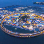
Among the project’s most compelling features is its digital reconstruction of the Osaka World Expo site. The model includes the expo grounds and the monumental wooden Grand Ring associated with Sou Fujimoto, along with selected pavilions captured using BIM and point cloud workflows.
This turns PLATEAU into more than a planning tool. It also becomes a platform for cultural memory and architectural preservation. In an era when temporary global events produce major design innovations but often leave limited public records, digitally archiving them in an accessible format is a meaningful step.
That cultural dimension gives this piece of architecture news broader relevance. The platform is not only mapping infrastructure and land use; it is also preserving the design legacy of contemporary Japan.
Open Platforms Are Redefining the Design Ecosystem
PLATEAU fits into a larger movement in which digital tools are becoming shared environments rather than isolated software products. Across the architecture and construction world, open databases, carbon platforms, material libraries, and collaborative technical resources are changing how knowledge is produced and used.
Japan’s model is especially noteworthy because it connects public governance with open innovation. Instead of keeping advanced city data locked behind institutional walls, it encourages experimentation by local governments, private companies, academic researchers, and technology communities.
That openness may be the project’s most exportable idea. Other countries looking to modernize urban planning, improve resilience, or support smarter design workflows could learn from the PLATEAU approach.
What This Architecture News Means for the Future
The big takeaway from this architecture news story is simple: the future of cities will be shaped not only by buildings, but by the quality and accessibility of the data behind them. Japan’s PLATEAU Project shows how open digital twins can support resilient infrastructure, smarter planning, environmental performance, and richer public understanding of urban space.
For architects, developers, and luxury design audiences alike, the lesson is clear. Better digital models lead to better real-world decisions. As more cities embrace open, standardized urban data, the line between design imagination and operational intelligence will continue to blur—and that could redefine how exceptional homes and exceptional cities are created.